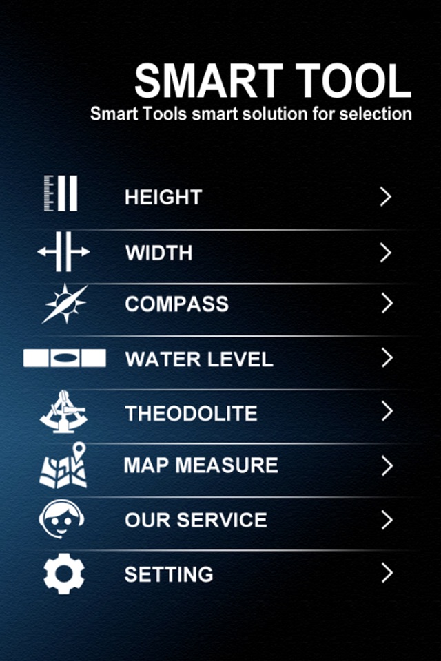


smart tool : clinometer + water level + compass + range finder + tape and map measure
Smart tool is collection of tool !!!
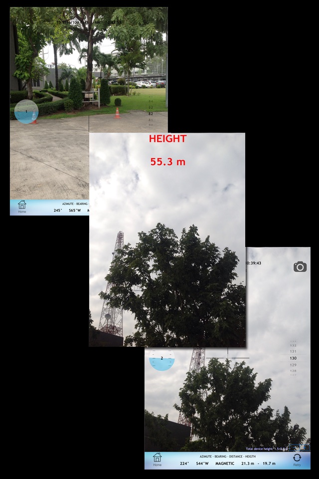
1. Tape measure : Two simply steps to measure height, width and distance without ever move your feet.
Tape measure can be used to estimate measure of furniture, houses and building.
Three type of measurements can be done with Tape measure - height and width of an object, distance between object and you.
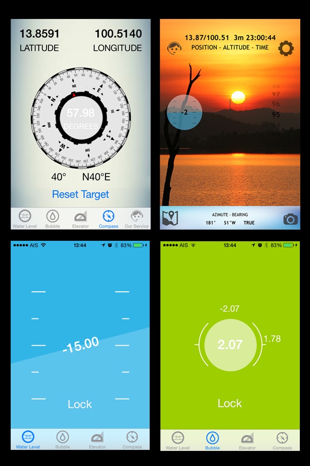
2. Compass : Use just like a real compass.
A compass is a navigational instrument that shows directions in a frame of reference that is stationary relative to the surface of the Earth. The frame of reference defines the four cardinal directions (or points) – north, south, east, and west.
3. Water level : A colorful minimalistic bubble level tool bulls eye level or just level tool.
Hold device flat relative to the ground to use as a 360-degree bubble level tool, or hold device vertical to the ground to use as a horizon bubble level tool.
4. Theodolite : Used mainly for surveying and have been adapted for specialized purposes in fields like meteorology and rocket launch technology.
That combines viewfinder, clinometer, compass, GPS and map.
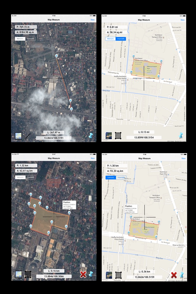
5. Map Measure : You can measure the distance and areas many points on the map.
Just click on the map to add different points - maps Measure will then calculate the distance and area. You may be an architect, a sports enthusiast or a geography hobbyist. It doesn’t matter why you have a keen interest in accurate distances, it just matters that you have the tools to satisfy your need to know them.